Historical Pictorial Sources on the State of Glaciers
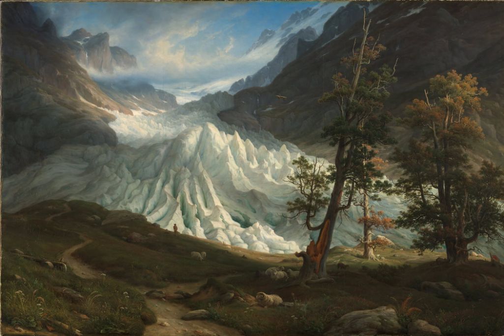
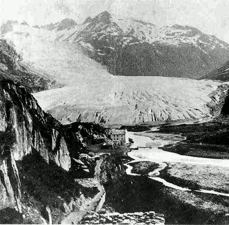
Glaciers in mountainous regions react very sensitively to climate change, as they integrate temperature and precipitation trends across all seasons. Their fluctuations are among the clearest indications of warming and cooling trends that nature provides us with. In addition to written evidence, historical images of glaciers in the form of drawings, paintings, prints and early photographs make it possible to reconstruct glacier levels in the Alps from the early 17th century onwards. A satisfactory amount of historical material is only available for those glaciers that achieved the necessary level of fame and attractiveness early on to draw travellers, scientists and artists. Illustrations in paintings and graphic art date back to the early 17th century, but only appeared more frequently with the emergence of the fashion for Alpine travel in the 18th century. Photographs are also available from the end of the 1840s.
The Lower Grindelwald Glacier in the Bernese Oberland is probably the best-studied glacier in the world in this respect. Heinz J. Zumbühl reconstructed its fluctuations using over 360 photographic documents in conjunction with chronicled records of the local population and reports by naturalists (Zumbühl 1980; Zumbühl 2009; Zumbühl et al. 2016). The Mont Blanc region with its prominent glaciers such as the Mer de Glace or the Glacier des Bossons was also frequently visited by travellers, scientists and artists, especially since the middle of the 18th century (Nussbaumer et al. 2012). In addition to the Alpine region, the relatively easily accessible glaciers in Norway also became the focus of interest in the 19th century, so that the number of surviving paintings, drawings and photographs allows an analysis of climate history.
Evaluating historical image documents is often difficult and requires careful analyses, especially before the 19th century. In order to be able to make optimal comparisons with regard to glacier extent, the images should fulfil three requirements:
- The image must be precisely datable, i.e. it must be possible to determine the time at which the artist photographed the glacier.
- The glacier and its surroundings must be depicted topographically correctly.
- The artist's location must be known.
The Euro-Climhist database currently contains around 300 images of glaciers, in particular the two Grindelwald glaciers, the Rhone glacier, the Unteraar and Rosenlaui glaciers, outside Switzerland the Mer de Glace and Glacier des Bossons (France) and several glaciers in Norway. The images can be categorised into one of these five image types:
The images can be categorised into one of these five image types:
Z = drawing; G = oil painting; D = print; F = photograph; K = map
In the case of oil paintings, it should be noted that these were often, but not always, executed after nature studies (drawings, sometimes watercoloured and gouached). In this case, the date on the painting usually refers to the year of completion in the studio, which is not necessarily identical with the year of the artist's journey to the Alps, which is decisive for the glacier status. In the case of graphic works (prints) and photographs, on the other hand, extensive research is often necessary and travel dates can usually only be obtained through artist biographies or comparisons of styles.


